|
INDIAN STATE :
MANIPUR
General Information
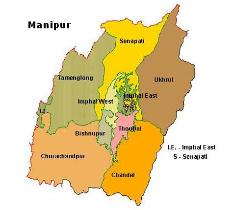
Situated between latitudes 23.80oN to 25.68oN and longitudes
93.03oE to 94.78o E, Manipur covers a total geographical
area of 22,327 Sq. km. Of the total area, about nine-tenths
constitute the hills which surrounds the remaining one-tenth
valley. It is one of the border states in the North-Eastern
part of India, bounded by Nagaland on the north, Assam
on the west and Mizoram on the south and along the east,
it shares a 352 km. long international boundary with
Myanmar.
Three kinds of ethnic groups inhabit the land of Manipur
namely the "Meiteis" in the valley and the
"Nagas" and the "Kuki-Chin" in the
hills. People sare predominantly Mongoloid and speak
Tibeto Burmese languages. English is the official language
and Meitei is the mother tongue of the people. Manipur
is blessed with the temperate climate through out the
year with two main seasons. Rainfall varies from 1000
mm to 3500 mm with an average rainfall of 2000 mm with
red fertile soil in the hills and alluvium soil in the
valley.
Fact File
| Geographical Area* |
0.22 (lakh sq. km) |
| Capital |
Imphal |
| Population (2001 Census) In lakhs |
21.67 |
| Percentage of State Population to
All India Population |
0.21 |
| Literacy Percentage· |
70.53% |
| Male Literacy· Female Literacy |
80.33%60.53% |
| Principal Language |
Manipuri, English |
* Excludes Mao-Maran, Paomata,Purul sub divisions of
Senapati districts of Manipur.
Source: CSO Estimates.
Nagaland Industrial Development Corp Ltd ,
Director of Industries & Commerce, Govt of Nagaland.
Climate
Manipur is blessed with a salubrious climate the year
round. It has two main seasons separated by two transitions:
- Winter (December to February)
- Pre-Monsoon (March and April)
- Monsoon (May to September)
- Post-Monsoon (October and November)
The southwest monsoon chiefly determines the weather
and rainfall throughout the state. The state has tropical
to temperate climate depending upon elevation. Rainfall
varies from 1000 mms to 3500 mms and average rainfall
is 2000 mms. Temperature ranges from sub-zero to 36
degree Celsius.
Advantage Manipur
- The state has a unique advantage acting as a gateway
to the east as sharing a 398KM international border
with Myanmar and the proposed South East Asia super
highway.
- Large potential of Human Resources available at
a highly competitive cost.
- Presence of reputed institutions of National importance
such as
- Central Agricultural University
- Center for Electronic Design and Technology
of India
- Central Institute of Plastic Engineering and
Technology
- Regional Tasar Research Center
- Manipur has been classified as a Global Bio Diversity
hot spot, which denotes an eco system rich in bio-diversity
and rare species.
- Manipur has a vast potential for the plantation
of exotic fruit like passion fruit, amla, olives,
figs, mandarin, orange, pineapple and bananas.
- The state has recorded the least consumption of
chemical fertilizers in agriculture and horticulture
farming.
- Manipur has around 100 varieties of Medicinal and
aromatic plants, which offers tremendous potential
for investment.
- The Saurashtra - Silchar super highway is extended
to Moreh. With the proposed extension to Thailand,
Manipur will become the gateway to South East Asia.
Economic infrastructure
Airways
Imphal is the second largest airport in the region.
Imphal is connected to Kolkata, New Delhi, Guwahati,
Aizwal and Silchar by Indian airlines and Jet airways
flights.
Railways
NH-39 links Imphal with railhead at Dimapur in Nagaland
215 km to the north.
NH-53 links Imphal with railhead at Jiribam 225 km in
the southwest.
Roads
Three national highways, viz., NH-39, NH-53 and NH-150
criss-cross the state connecting all districts.
The Saurashtra- Silchar Super Highway project is being
extended at Moreh. With the proposed Moreh to Mae Sot
(Thailand) highway coming up, Manipur will become the
gateway to South-East Asia.
|